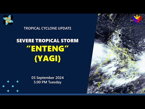
The powerful Typhoon Yagi is currently reaching wind speeds of 184 to 201 km/h, with gusts surpassing 17 levels. Moving at a west-northwest direction, it is expected to cover approximately 15 kilometers each hour. By late tonight, forecasts predict that Yagi will approach the waters of the Gulf of Tonkin, where it may weaken by one or two levels, though gusts will still peak at level 17.
The storm’s influence is already being felt along the eastern coast of the Gulf, with reports of strong winds reaching level 6 on Bạch Long Vĩ Island this afternoon. To keep abreast of this situation, residents are leveraging various media outlets, including television, to receive timely updates about Typhoon Yagi. Additionally, many are utilizing their smartphones and tablets for real-time information.
Applications such as Windy, available on both the App Store and Google Play, offer free access to weather insights. With an intuitive design that adapts to the user’s language settings, the app requires simple permissions allowing it to provide location-based updates and critical notifications.
The app features a wealth of tools including satellite imagery and detailed forecasts. Users can anticipate the storm’s trajectory and intensity, helping them prepare accordingly. For instance, predictions indicate that by morning, Typhoon Yagi could near Cô Tô Island in Quảng Ninh, reaching the mainland by early afternoon. This global weather tracking platform not only focuses on Yagi but also monitors other storms worldwide, offering detailed meteorological data.
Monitoring the Path of Typhoon Yagi: A Comprehensive Overview
As Typhoon Yagi continues its intense progression through the western Pacific, understanding its trajectory and potential impacts has become crucial for residents and authorities alike. Due to the typhoon’s imminent arrival in populated areas, effective monitoring strategies are essential for ensuring safety and preparedness.
Key Questions Surrounding Typhoon Yagi
1. What are the expected impacts of Typhoon Yagi when it makes landfall?
As Yagi approaches land, it is likely to bring heavy rain, storm surges, and severe flooding, particularly in coastal regions. The National Weather Service has already warned of potential power outages and infrastructure damage.
2. How is information about Typhoon Yagi disseminated to the public?
The public relies on various channels such as local news broadcasts, meteorological websites, and mobile applications. The timely dissemination of information is vital, especially as conditions can change rapidly during a typhoon.
3. What technologies are used to monitor Typhoon Yagi?
Meteorological organizations utilize satellites, Doppler radar, and advanced computer models to track and predict the path of the typhoon. These technologies allow for updated forecasts and real-time data to be shared with the public.
Challenges and Controversies
One of the key challenges in monitoring Typhoon Yagi is the accuracy of predictive models. The unpredictable nature of weather patterns can lead to variability in forecasts, causing confusion among residents. Additionally, there is ongoing debate about the best strategies for disaster response and evacuation. Ensuring that vulnerable populations receive timely warnings and assistance remains a significant concern.
Advantages and Disadvantages of Monitoring Technologies
Advantages:
– Real-time Data Access: Technology provides immediate updates, allowing communities to make informed decisions.
– Global Tracking: Monitoring platforms enable comparison with other weather phenomena, aiding in preparedness across various regions.
– User-Friendly Apps: Applications like Windy and others allow for personalized tracking, which can help individuals gauge local risk.
Disadvantages:
– Overreliance on Technology: Some may fail to consider information from multiple sources, potentially leading to complacency during emergencies.
– Digital Divide: Not everyone has equal access to technology, leaving some communities inadequately informed.
– Information Overload: With an abundance of updates from multiple platforms, residents may experience anxiety and confusion regarding the actual severity and urgency of the threat.
As Typhoon Yagi continues its path towards the Gulf of Tonkin and mainland Vietnam, residents and authorities must prioritize accurate information and coordinated responses. Preparing thorough evacuation plans and ensuring robust communication networks will be essential in mitigating yet another natural disaster.
For ongoing updates and resources on Typhoon Yagi, consider venturing to official weather tracking websites such as the Weather Channel and the National Hurricane Center.